Wednesday, September 05, 2007

Bitragunta

Bitragunta is located between Vijayawada and Chennai on the east coast trunk line of Indian Railwys. The town is in the Nellore district of Andhra Pradesh. Nearest major stations is Nellore to the south and Ongole to the north. A few express trains do halt at Bitragunta today.

Bitragunta’s significance lies in the history of the Steam Era. The abundance of suitable water and availability of plain land enabled the construction of a unique Mechanical Loco Shed. The loco shed was first constructed in the year 1885. A roundhouse with turn-table facility was added in 1934. The roundhouse was known for its architectural value and joined the Mysore roundhouse as one of two spectacular loco sheds in the country. At that time, the loco shed handled 45 steam locomotives and later went on to become one of the biggest in the Indian Railways. Bitragunta was also provided with a major yard and also inter-changing depots for the drivers and guards.

The steam shed was logistically important to medium and long distance trains originating from Madras and the ones passing through Vijaywada down south. In those days, experiments were being made with the Pacific locomotives (WP) of the Grand Trunk Express to provide it more mileage in terms of water and coal consumption. The objective was to provide the GT with a non-stop run between Madras and Vijaywada. The WPs were fitted with water scoops, to enable them to take on water while on the run. A water trough was constructed at Bitragunta just for the purpose. The water scoops on the WPs worked well enough. Unfortunately, due to a deteriorated level of the quality of coal, the engine had to be changed at Bitragunta. The coal carried in the locomotive's tender could not sustain the 420 km long journey, due to the high ash content. Bitragunta had 22 WP locos in its shed then. Later, the shed, under South Central railways held 59 WG and 5 XD locomotives.


Along with the growth of Indian Railways, the marshalling activities at Bitragunta increased manifold. In 1968, a full-fledged marshalling yard with hump facility was established and a wagon-repair depot was added later. The marshalling activities included segregation of wagons and long-distance marshalling orders. The activities continued until 1998.

Bitragunta was also a known “railway cantonment”. Predominantly occupied by Anglo Indians, it had 1000 spacious railway quarters built in European style. It also hosted a Western Culture Institute that is standing till today as the legend of those glorious days.

The evolution in the mode of traction power from steam to diesel and diesel to electric caused the reduction of shed-activities and finally the steam shed at Bitragunta was closed. The closure of the marshalling yard brought a complete closure to the glory of the railway town. Consequent upon the closure of the steam loco shed in Bitragunta, the infrastructure, other equipment and land have not yet been utilized for any purpose.


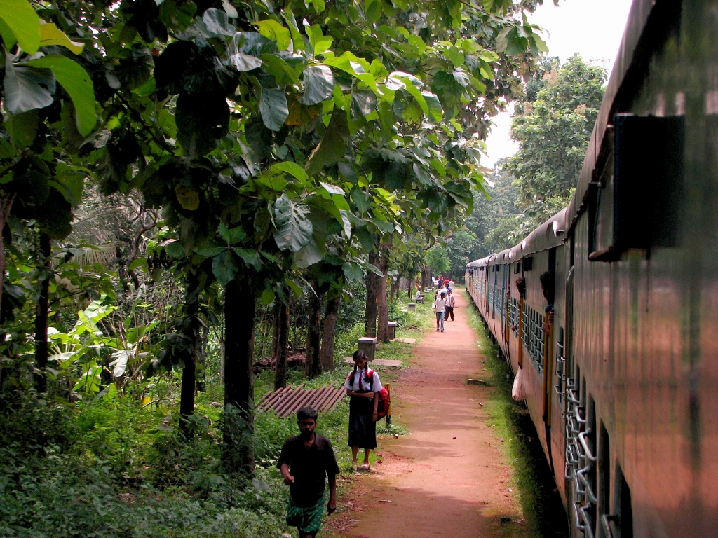
But Bitragunta still continues as a changing point for all up & down freight trains. Most of the express trains continue to halt here. An ART and MRV are still stationed at Bitragunta. The station still retains vestiges of the glorious past in form of its long platform and old buildings. The remains of the steam shed and the roundhouse can still be seen today.

Sunday, September 02, 2007

Two days in Kerala

One of the first things that strikes you in Kerala is the abundance of vegetation. What struck me immediately (and literally) were the teak trees when I took the train from Palghat to Nilambur Rd. I had seen teak in AP, Karnataka, Orissa, Chatthisgarh and even Tamil Nadu. I had seen them in abundance on the Nagpur - Chindwara narrow gauge route too. But none as abundant as on the Shoranur-Nilambur Road branch line.


The trees grew right next to the tracks and their leaves literally slapped anyone daring a footboard travel; so close were they. There are plantations of jackfruit, banana, coconut palm, areca, cashew, pepper and of course, rubber.

I was amazed by the green coverage but worried about forced plantation. Nature does not grow in patterns. Nor does it favour one species over the other. Despite the Darwin theory of survival of the fittest, nature is a great equalizer when it comes to vegetation. In any case, it is not the rubber or jackfruit I am worried about. The worrisome ones are eucalyptus and areca which require least maintenance and generate enough cash. The trouble with these is under their roots. Eucalyptus drains the water table. Areca with its shallow roots loosens the soil and causes erosion. Areca nuts were called Green Gold in Taiwan for their commercial value. But the roots of areca are shallow and grow laterally, preventing water to seep deeper and replenish the ground water table. In cyclone or heavy winds, areca cannot protect the soil from being washed away. This problem is specifically acute in hilly areas or slopes where the soil erosion is even more acute.


The line from Ernakulam Jn to Kayamkulam Jn via Allappuzha was equally exciting as i travelled on it early in the morning. The abundance of water was evident with the greenery, the ponds and bckwaters. Thankfully, the villages dotted with little bunglows were not as predictable with their greenery. It was a pleasure to see a good variety of trees within the kitchen gardens of the houses. It was difficult to tell a town from a village thanks to the thick green cover and vast spaces between houses. Elsehwere, we would have been travelling through a concrete jungle bereft of any vegetation.


Kollam to Tenkasi was another round through plantations, the same rubber, teak, jackfruit and banana types. This route however has steep gradients that enlivened the journey. The route passes through a break in the Western Ghats (specifically the cardomon hills) and captures a wonderful scenery within itself. The little stations are thickly lined with teak and jackfruit and resemble neighbourhood parks rather than drab stations!

Sunday, August 12, 2007

Bastar and Dantewada

On July 14, 2007, four of us (Roopesh Kohad, Pareekshit and Praveen) took a car right through the Maoist stronghold of Bastar. Our destination was the Chitrakote Falls in Chattisgarh. Here is a report on the trip:


We started off on July 13, 2007 from Hyderabad in a Tata Indigo (diesel car) at 1530 hrs. We wanted to drive through the forests of Bastar to Jagdalpur and from there to Chitrakote. Our immediate destination was Bhadrachalam on the banks of river Godavari from where the highway to Jagdalpur started.


Listen to Bhakta Ramadas song on Bhadrachalam
Get this widget | Track details | eSnips Social DNA

Day 1

The monsoon had started to recede, though there was a considerable amount of rainfall. The route is like this:Bhadrachalam - Chintur (diversion)- Konta (diversion)- Penta- Mothugudem -Sukma- Kukanar-Darba-Tirathgarh-Sosanpal-Jagdalpur-Chitrakote. The road was a National Highway (No 202) and unlike other highways, was a narrow road in a real bad shape. At places, the macadam surface is missing completely and the rains had rendered the road muddy and slushy. However, post Konta at the AP-Chattisgarh border, the scenery began to change rapidly into a thick and lush jungle to make up for the bad road.


There were numerous streams and rivers in spate with muddy water. Principal among them was the river Sabari which ran along the road to join the Godavari at Chintur. We were driving upstream for many miles.The route was patronized well despite the bad state of the road. We had a steady company of loaded trucks, buses, jeeps, off-roaders, auto rickshaws and tractors. One common thing throughout the trip were cows and goats. Somehow, we saw more cows, goats, dogs and chicken than human beings.


Barring the animals, the next most common sight were police! Chattisgarh has recruited an entire army of para-military forces to check the Maoist (Naxalite) menace. Special Group and CRPF (Central Reserve Police Force) cops manned the checkposts in every village. There were fortified barracks next to the checkposts at every village.

Thanks to the monsoon, the land was swathed in different hues of green. The forests typically consisted of teak, sal (Shorea robusta) and mango trees. The fields were planted with rice all over. Offthe fields, grass grew lush and green, evidently fed with monsoon water. Numerous streams overflowed with muddy water, forcing us to stop and savour the scene.


Post Kukanar, the road seemed to improve. We took in the ghats of Darba to the first destination of our trip - Tirathgarh Falls, nestled deep in the mountains.The approach to Tirathgarh consisted of a narrow but well built road. Thanks to the monsoon, there was enough water to retain its magic. The water was a river that originated from a lake further up stream. Water tumbled down from a height of 100 feet over a wide column of rock on to a flat piece of land before slipping down further along the slopes of the mountain into the forest. There were a couple of small shrines beside the stream. A series of steps led us down to the foot of the falls. The water was shallow enough to wade through and reach an appropriate spot to sit and watch the water cascade down. The falling water gave rise to a spray of droplets that kept clouding my camera lens. We spent quite sometime at the falls. There were not many people around. It was not a season of tourists. The entire region is still waiting to be discovered.


We resumed our journey to Jagdalpur and reached Sosanpal where we took the road from Gidam to Jagdalpur (NH 16). At Jagdalpur, we did not find it difficult to find the way to Chitrakote. This road was amazingly broad and well built. We hit a good speed on the road and reached Chitrakote (39 km away) in 20 minutes. The falls were right beside the road but we could not make much out of it in the fading light.At the end of the road and overlooking the falls was the Public Works department's guest house. It was now was undergoing major renovation, probably being converted into a tourist guest house.Adjoining the building was a dirt track that led to the facility built by the Chattisgarh Tourism for tourists. This is a resort that is still being constructed. The department had erected 5 log huts as a temporary measure to attract tourists. A good part of the landscaping was completed. The resort was built at a higher ground than the river. There were a series of concrete cottages being built the edge of the plateau, that offered an uninterrupted grand stand view of the falls from their balconies.The huts were at a disadvantage thanks to these new facilities which blocked the view of the falls. In any case the huts are a temporary solution.


We made a quick detour of the falls at 10 PM. The caretaker of the resort had someone switch on a few floodlights to enable a good view. We were standing at quite close to the drop. The sheer force was evident from the thick mist that rose from the base and filled the air. The roar of the falls in the darkness rendered it eerie and frightening.


Day 2
Chitrakote falls hits you in the face with its granduer. Though not in the league of some of the major falls of the world, the falls on the river Indravathi is nevertheless breathtaking to look at especially in monsoon. The resemblance to Niagara falls is uncanny even though the Canadian-American falls is much bigger. The mouth of the falls is a concave curve. The monsoon rains had caused a lot of water to flow from the catchment areas of the river valley flow into the river with silt and sand causing the Indravathi to swell and inundate the banks.


The caretaker invited us to his favourite haunt. A remote river beach about 2 km downstream from the falls. We had to descend a rough and rock-hewn slope down to the spot. The climb down was trecherous thanks to the slippery smooth stones. But we were rewarded with an absolutely untouched and unspoilt little beach by the cascading muddy waters of the river. The caretaker, Mr. Tiwari rarely brings anyone here and we were the chosen ones of the day thanks to our enthusiasm. The beach kept us in a rapture for quite sometime before we ascended the slope that drained us of all energy.


Later we descended another slope down to the falls. The river had swollen enough to encroach upon dry land with its muddy waters. There were trees right in the middle of the river with the falls in the background. We walked close to the falls and observed it in complete awe standing on the rocks jutting out. Despite all the mud and silt, the falls still generated a great cloud of mist. The force of the water over the years had cut through the rock at the top forming a sieve. It was difficult to get a snap thanks to the continuous spray of water droplets that filled the air.


A cursory detour to the edge of the falls at the same point where we first viewed the falls at night completed out tour. We stood there watching the volume of water cascading down in sheer amazement. It took us the good part of the day to savour the falls as we returned to Jagdalpur, stopping en route to check out the Shitaldhara falls which left us cold and unmoved after the spectacle of Chitrakote. We spent the night at Jagdalpur.


Day 3

We started early. Our plan was to take the National Highway 16 to Hyderabad. Our road atlas showed the highway going all the way to Bhoopalpatnam on the border of Chatthisgarh and AP and further to Mancherial. We were to take a diversion at Bhoopalpatnam to Venkatapuram and cross the Godavari to join the National Highway 202 to Hyderabad enroute Eturunagaram and Warangal. The ride out of Jagdalpur was exciting as the well built, wide road allowed us to cruise at a good speed without a single pothole or speed breaker. We crossed Sosanpal and came close to the Kothavalasa- Kirandul railway line. We were confident of touching Gidam, about 45km away in the next half hour. It took us 3 hours. About 20 km after Sosanpal, the smooth road turned into a minefield of mud and slush. A temporary aberration was what we thought as we spied a board stating that the highway was under construction by the Border Roads Organization.


The aberration lasted all the way till Gidam that tested the mettle of our car. Post Gidam, the road switched between bad to terrible as we tried our best restrain our frustration and the traction of our car. The presence of gun-toting para-military men on patrol (looking for Maoists) and the increasing forestry did not help us with our confidence either. A consolation was the virgin landscape draped in hues of green.


10 Km from Bhoopalpatnam, a group of travellers on a Scorpio coming down the road finally made us wiser. They told us that NH16 does not exist yet! It has been under construction for more than 10 years and almost abandoned. The milestones indicating the distance to Nizamabad were all wrong. There was no bridge across the Indravati to help us cross into AP. Worse, the detour we were supposed to take at Bhoopalpatnam did not exist either thanks to the lack of a bridge across a couple of rivulets that were in spate thanks to monsoon. Had it been summer, we could have waded through the shallow waters. They advised us to turn back immediately and head back to Gidam and from there to Dantewara. It was not safe in tyhese parts as the day wore off. We cursed our luck, the government of Chattishgarh, the Eicher Road Atlas, the Maoists and for a good measure, the town of Jagdalpur where none warned us about this. We had just travelled 200 Km on a road that does not exist! We turned back and headed for Gidam, braving the rain and the slush, rescuing the car a couple of times from the mud using physical force. We hit gidam just before nightfall and reached Danewada where we spent the night.


Day 4
The next day, we took the road to Bailadilla which was in great shape and diverted to the road to Sukma to meet the same highway we had entered Chattishgarh on. By 2 PM we were at Bhadrachalam, in one piece. Thus ended our tour of Bastar. Next time, we shall make discreet enquiries about the road conditions before we rely on road atlases!

Tuesday, July 10, 2007

Dorabavi Viaduct

These are some hastily snapped pictures of the erstwhile Dorabavi viaduct. I snapped them on TV while it was being shown in a movie.

This Viaduct was opened for metre gauge traffic in the year 1887 and was a part of the former Metre Gauge route between Guntur and Guntakal. A hallmark of engineering, the viaduct was built somewhere between Diguvametta and Chelama on the Nandyal - Giddalur Section in those days.

There was a major realignment of the route during gauge conversion which took the new Broad gauge line away from this spot. The viaduct was abandoned and later dismantled. Sadly, it does not exisit anymore.


Tuesday, April 17, 2007

Little Rail Bus - Bull Run II

Shimoga - Talguppa Rail Bus. April 14, 2007

I did it again. I travelled on the Shimoga - Talguppa rail bus for the second time. The last time I did it was in 2004 . This time, I travelled on it with a group of 8 others. I could not have photographs the last time and instead wrote a long and nice trip report. This time I keep the words short and say it with pictures.

All photos are by Bharath Moro except where indicated.


Tucked away in a corner of Shimoga railway station is the sole and tiny platform for the Metre Gauge Rail Bus. The bus is an articulated one with a trailing cab. It is a typical Ashok Leyland bus with an internal combustion Hino engine. Braking is however a vacuum affair.


The bus has the typical steel rail wheels. The controls are similar to a normal bus except for the lack of a steering wheel. The horn is typical bus type except that it is an air horn like a normal locomotive mounted on the top. The rail bus cab also has a sander. Seen here are the two lights on before departure. The time is 6.20 AM and the lights are not required. They are put on just for the photograph.


We started to roll along the worn out tracks. The bus does not have the typical rail shock absorbers. Instead it has a leaf-spring absorber that is ineffective in absorbing the jerks. Seen here is the unique operation of gates. This line is quite basic with only one round trip service. hence there are no gatekeepers. The guard doubles as a gatekeeper. The bus slows down before each level crossing and the guard gets down to close the gates/stop traffic in case of gateless crossings. He then lets the bus pass the crossing and reopens the gates. The bus waits for him to return and then moves ahead.


The line is quite old and passes through some variety of terrain. Hence a lot of speed restrictions as seen in the photograph. There are a lot of steep gradients en route.


We reach Haranahalli the first stop as the sun rises. There are no proper platforms all along the route. Just little elevations. Years ago, normal trains used to ply this route behind steam locomotives. Stations have dilapidated ever since. but the little bus still has its patronage in the rural hinterland of Karnataka.


The bus is straight out of the 1960's. The line is more than 60 years old and bumpy. But the forest scenery rolling outside the windows is priceless.


Interiors are cramped and tiny but neat. Seen here is the guard who has to share seat with the passengers. Photo by Ranga


It is April, well into typical South Indian summer. But the higher altitude of Malanad still affords some mist and fog. The weather is cool and fresh.


Visibility is just about adequate. Malanad is a rain-fed countryside. It rains quite often here and that is the reason for the evergreen forests in the countryside.


A view from the driver's cab of the rail bus. The mist adds to the excitement of this little railway.


Kenchanahallu at 7:45 AM. We are halfway between Shimoga and Talguppa. This is a 'tea-halt'. the crew takes a break for some breakfast and tea. Kenchanahallu is a beautiful station along a state road. the road passes right through the station. Photo by Ranga


The passengers take a break along with the crew at this tiny station. Photo by Ranga


Kenchanahallu is amidst tall and shady trees. It is all quite and peaceful here. Photo by Ranga


We take the opportunity to have some refreshments ourselves. We followed the crew to this little hut next to the station that provided us delicious idlis and hot tea. Photo by Ranga


We resumed our journey after a while. Seen here is the guard operating the gates and running back to the train blowing his whistle to indicate Proceed. Seen here is the National Highway from Bangalore to Honnavar. Photo by Ranga


Adderi is a quiet and earthy station with big trees in the middle of some woods. An old lady and her grand-daughter walk away into the village. Photo by Ranga


We are now approaching Sagar, the biggest town in these parts and also the biggest station.


Sagar (Jambagaru) railway station is a grand building, almost abandoned now. It used to have retiring rooms before. Despite its age, it still stands strong and beautiful reminding one of the days of the Raj.


The empty space beside the station used to host a number of loop lines long ago, now dismantled. Sagar was a major station and goods yard in the olden days. The rail-bus stopped for 15 minutes here.


A lttile distance from Sagar was the Section Engineer's office which displayed teh history of this line as seen here. RRB - Birur. SME- Shimoga. SMET- Shimoga Town; ARU-Arasallu; ANF-Anandapuram; SRF-Sagar Jambagaru; TLGP-Talguppa. This line is up for broad gauge conversion and that would mean the end of this rail bus. But mericifully, the scenery would remain.


Interestingly, the station is called Sagar Jambagaru while town is called just Sagar. A nice pic by Bharath Moro.

VSP takes a respite. He has a facewash at the only water closet at Sagar station, which, surprisingly is working. Photo by Ranga.


The commercial goods transported on the rail-bus - cane baskets meant for some village market. Photo by Ranga.


The sign on the top of the door says "Nimma tale Hecharike" or "Take care of your head" in Kannada. vivek Pillay seems to be just aware while Lakshman (right) is more cautious.


We approach our destination: Talguppa, the terminus of this line.


Talguppa has a quite and serene atmosphere thanks to all those trees and a quaint old building that is surprisingly neat and tidy.

It is 10:30 Am now. The bus will return to Shimoga at 5:20 PM. Before that the cab of the bus has to be reversed and attached on the other side of the trailer car.


The driving cab is detached and taken to a branch line by switching the tracks manually. Seen here is the manual switch that is fast disappearing all over India being replaced by automated switches.

A closer look at the switching device, which has key to prevent accidental switching.

The driving cab is taken to the end of the branch line to a tiny turn table. The cab is placed on it to reverse its direction.

The crew is pushing the cab around to reverse its driving direction. Since the bus is very light, the crew simply pushed it onto the table using their hands. The turntable rotates on a set of bearings and is easy enough to be operated manually.


The found it easy to push it clockwise.

The cab is now reversed. It is ready to resume its lead position in the return trip.


The trailer cab hasdbeen pushed onto a switch line, the switch operated by a manual lever. Now the driving cab will be pushed back to attach it to the trailer.


The trailer and driving cab are hitched together.

The formation is brought back to the platform where it will rest till evening. The crew retire into the woods to take a well deserved nap and rest.


The team at Talguppa by the bus (before reversal). L-R: Colin Peter, Lakshman, Tejender Reddy, Assistant Loco Pilot, V Srinivas Prasad, Vivek Pillay, Praveen PVS, Bizzy Mishra and Bharath Moro. Squatting - yours truly.


Talguppa station building is a neat and cool place straight from the 1940's. It has an interesting architecture that is well maintained. Seen here are the two ticket windows. Surprising for a small station of a small village that sees only one round service a day. But the station has a reservation quota to book on the 6228 Shimoga-Bangalore Express. One of my favourite stations. I just hope that gauge conversion does not see the end of this beautiful station.